Norman Center City Infrastructure Analysis
Johnson & Associates created an infrastructure analysis for the City of Norman in the area of The Norman Center City Form-Based Code (CCFBC).
BOUNDARIES
Boyd to Main, and from Flood to the Railroad tracks on the east.
OBJECTIVE
Move the character of the neighborhood from single-family detached, to a mix of single-family detached, townhomes, condos, apartments, and other high density uses.
NEED
An analysis of the area’s existing infrastructure was needed to realize the vision of the CCFBC.
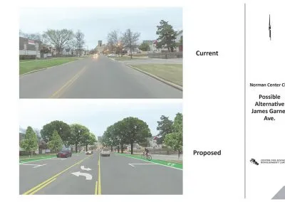
Johnson & Associates created a report that assumed a complete reconstruction/upgrade of all noted infrastructure and the addition of landscaping for improved streetscapes. To do so, roadways, alleys, water lines, sidewalks, and landscaping would be removed and replaced with one cohesive design.
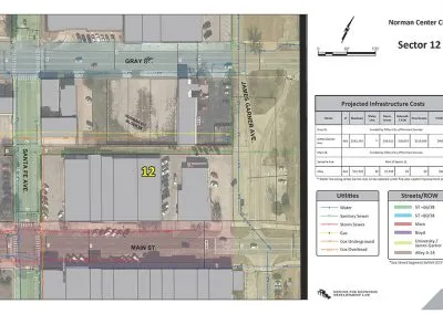
Johnson & Associates worked collaboratively with the Center for Economic Development Law, the City of Norman, and private utility companies to identify:
- Right-of-way widths
- Street widths
- City utility information (water, sanitary sewer, and storm sewer)
- Private utility companies’ infrastructure (electric, gas, and cable)
With comprehensive GIS and field measurements, we provided a map and report that delineate the city streets and their appropriate street section, allowing the City of Norman to estimate the cost of the streetscape improvements and utility replacement in any given sector. Considerations included landscaping, irrigation, street lighting, and sidewalks, and intersection improvements include signage/wayfinding, striping, and ADA accessibility.


